
We’ve all had the experience of going back to a favorite Hawaii place and finding exactly what we remembered, including eve the parts we hoped might have changed. The parking is still overflowing, cars are still stopping where they shouldn’t, the restroom you were counting on still isn’t there or is unusable, and everyone there seems to be trying to figure out what to do at the same time.
We went through Hawaii’s new island-by-island plans just released, expecting many of those familiar names to jump out at us. Some did. Others we kept looking for, including Diamond Head, Hanauma Bay, Waikiki and Poipu Beach, and they never became priorities for targeted action this time around. Why?
Hawaii has decided on a much smaller group of places to focus on for the next two years. If one of them is part of your next trip, here’s what the state is actually proposing to change, and just as important, what you probably won’t notice happening anytime soon.
Maui starts with the one road where the stakes couldn’t be higher.
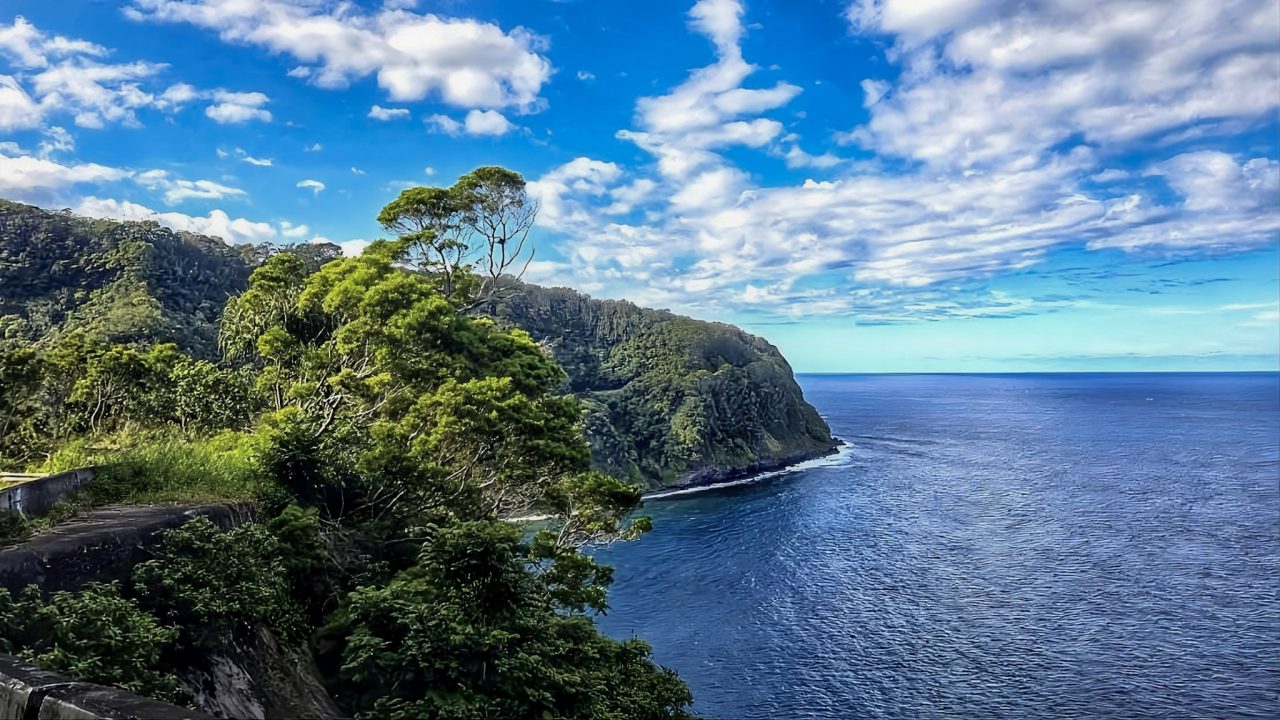
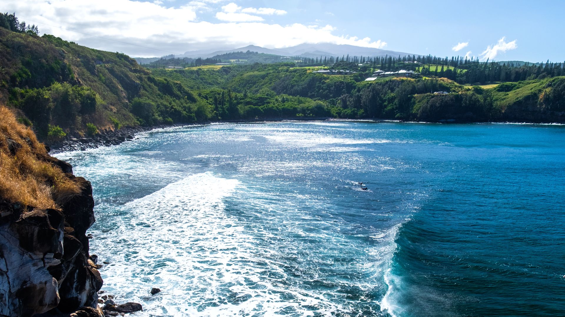
If you’re driving the Road to Hana, as Beat of Hawaii editors will be next week, stopping at Honolua Bay or thinking about continuing around Maui’s backside through Kaupo, all three are now part of the state’s new focus. What caught our eye first, though, wasn’t another overcrowded beach or Instagram stop. It was Mile Marker 36 on the Piilani Highway.
The state’s Maui Destination Management Action Plan for 2026-2028 describes an unstable-ground area there where a fatal accident occurred and where visitors continue to stop without clear hazard warnings. Kaupo residents also reported blind one-lane hills, higher speeds since the road was paved, near misses, and collisions. There are no restrooms or formal areas to stop through this stretch, leaving visitors pulling onto shoulders when they are looking for somewhere to stop.
This one isn’t just another Hawaii study. Maui County is supposed to review specific hazard locations, including the one at Mile Marker 36, and determine what can actually be installed. The possibilities named in the plan include warning signs, flashing indicators for approaching traffic, speed treatments (humps), and visibility improvements.
The Road to Hana that we all think of has bigger plans. Visitors may eventually see better turnout guidance and roadway markings, while Keanae is slated for an on-site stewardship presence. Maui County is proposing a certification program for Hana Highway tour guides. The plan acknowledges what anyone who has driven this road already knows: visitors often don’t know where it’s safe to pull over, shoulders are narrow, turnout visibility is inconsistent and cell service isn’t always there when you need it.
Then there’s Honolua Bay, where the change could eventually be hard to miss. The plan calls for off-site parking, reservation-based entry and shuttle-supported arrival, backed initially with state funding for the reservation system, shuttle and visitor orientation. That would be a very different arrival from today’s roadside-parking experience if it gets fully implemented.
What surprised us on Maui was everything that wasn’t chosen for this kind of targeted work. Makena and Big Beach aren’t priority hotspots in this next two-year cycle, nor are Kaanapali, Napili, or Iao Valley. Separate agencies can still do work at any of them, of course, but this particular statewide plan doesn’t suggest different experiences at these on your next visit.
For Maui visitors, Honolua is the place where the proposed change could eventually become the most obvious. Along Hana Highway and through Kaupo, the first changes will be smaller and more practical, such as signs, safer driving cues, stewards and clearer instructions about where you should and shouldn’t stop.
Oahu left off some names we did expect to see.
We looked for Waikiki. We looked for Hanauma Bay and Diamond Head too, especially since the state’s Oahu Destination Management Action Plan for 2026-2028 itself points to Hanauma Bay and Diamond Head as examples of places where managed access already works. None of the three was selected as Oahu priority hotspots for this cycle.
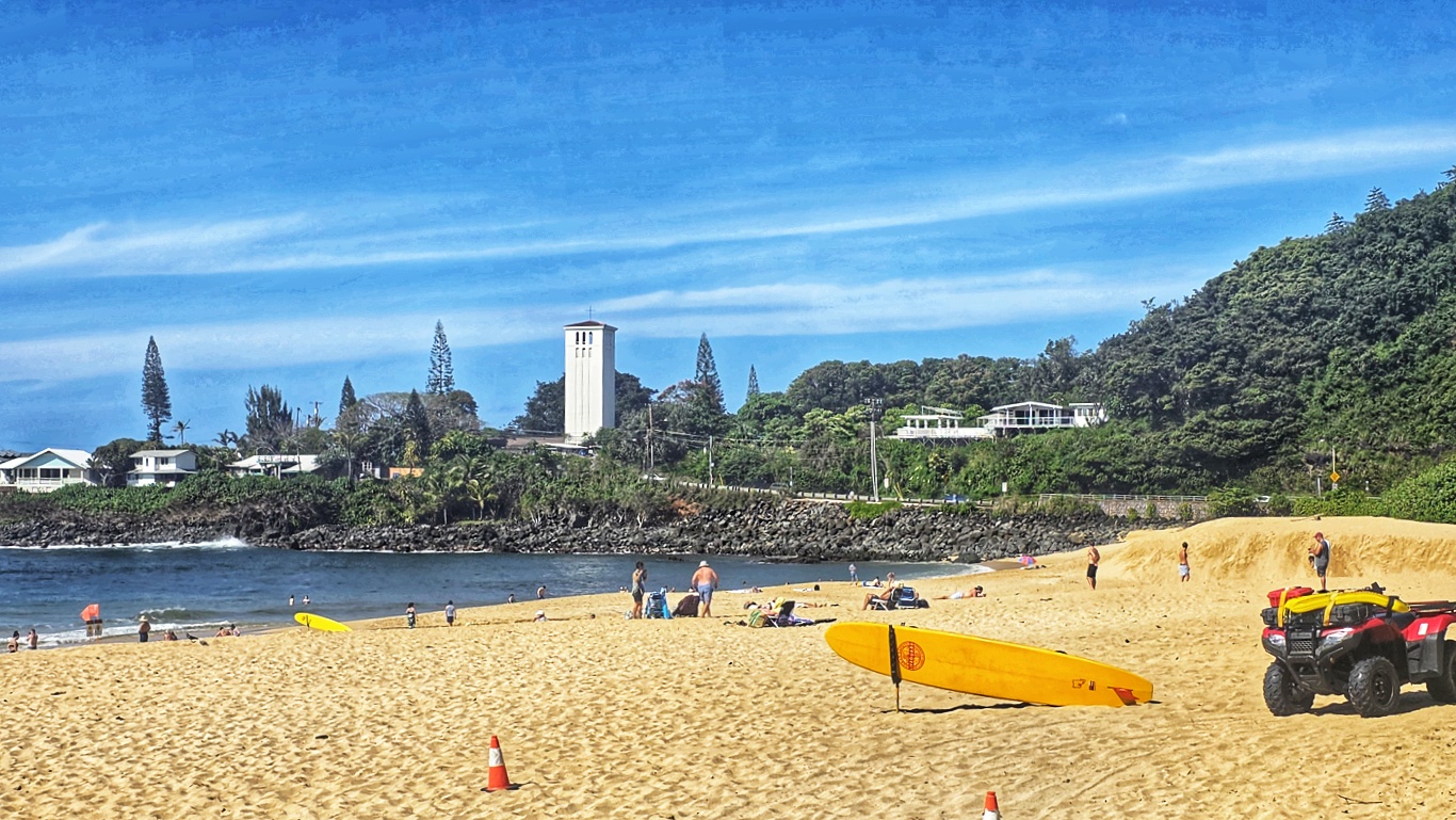
Instead, the biggest plan is for the North Shore, and it’s hard to argue with the problem they’re trying to solve. It’s estimated that about 40% of Oahu’s visitors make the trip north, sending thousands of cars each day onto a narrow two-lane corridor where visitors circle for parking, make abrupt roadside turns and stops, and cross busy sections of Kamehameha Highway on foot.
Don’t look for another traffic lane to suddenly appear. The most visitor-visible idea is a park-and-ride circulator shuttle that would operate during peak periods, with the state first studying where it is most needed and where such a shuttle could realistically stop. If this pilot advances, it is supposed to connect parking with destinations along the corridor and include visitor information along its way.
Kaiwa Ridge, better known to many visitors as the Lanikai Pillbox hike, also made the cut. Here again, the immediate answer isn’t for new parking. The plan first calls for determining what managed access might look like and then testing a “park once” concept that could let visitors leave the car elsewhere and use existing bus service, a shuttle or bikes instead of circling Lanikai and Kailua looking for places to park.
Puu O Hulu Kai, commonly called the Maili Pillbox trail, is being treated as an emerging problem rather than waiting until it becomes another Lanikai. The plan calls for pursuing formal Na Ala Hele designation and looking at access and parking solutions, although that is much more groundwork than something most visitors will immediately see.
So if your next Oahu trip is centered around Waikiki, Diamond Head or Hanauma Bay, how should you read this? It means they aren’t where this particular 2026 to 2028 effort is being concentrated for new targeted hotspot work. The North Shore is where a visitor could eventually encounter the biggest change, especially if the shuttle experiment makes it beyond planning and onto the road.
Kauai gave us perhaps the strangest mix.
If you’ve sat in Kapaa or Lihue traffic with us, one choice won’t surprise you at all. The Kapaa-Wailua corridor is a priority, and the Kauai Destination Management Action Plan for 2026-2028 describes exactly the problem residents and visitors share every day: nearly everyone gets funneled through the same road, while parking, pedestrian movement and wayfinding simply haven’t kept pace for decades.
Coconut Marketplace is supposed to get a staffed visitor information booth, and the corridor is slated for at least 25 new wayfinding, interpretation and stewardship signs connecting visitor parking, the coastal path, Wailua, Waipouli, Kapaa and Coconut Marketplace. The more complicated plan includes an East Kauai mobility hub tied into a broader shuttle network that is hoped could help reduce rental-car dependence.
Hoopii Falls is on the list. This is a place that went from being promoted as a “hidden waterfall” to a neighborhood flashpoint involving parking concerns, informal access, trespassing and safety. Rather than deciding now that the best solution is either more parking or easier entry, the plan puts virtually everything on the table, including limited entry, guided access, relocated parking, community stewardship and even partial or full closure.
That means visitors heading there shouldn’t assume “priority” means the state is planning to make Hoopii easier to visit. It could ultimately mean a more controlled experience, a different way in or less access than people have today. In the short term, the most visible piece may simply be stronger online warnings and less promotion of it as an easy hidden stop.
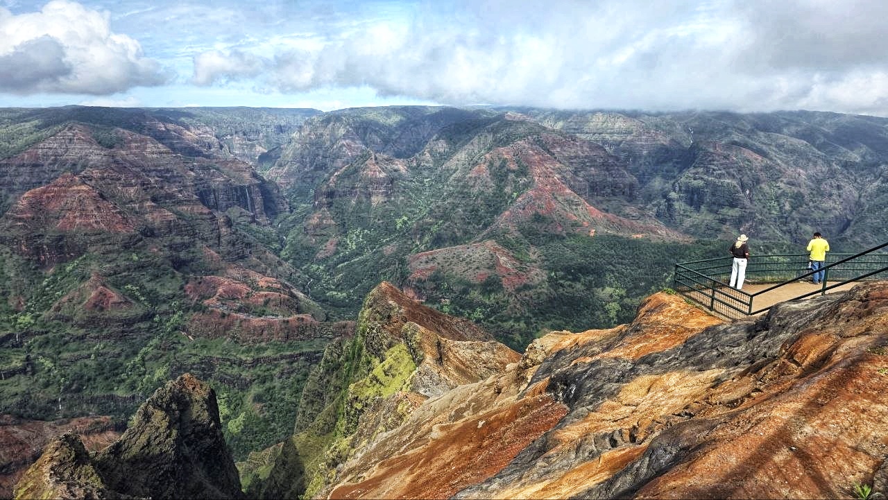
Kokee and Waimea Canyon are also priorities, but don’t expect a new shuttle to be waiting for you this year. The state first wants visitor counters at trails, lookouts and roadside pullouts, safety signs and stewards, followed by a feasibility study of both shuttles and managed-access options. Waimea Canyon Drive is also getting a separate look at the haphazard roadside pullovers and pedestrian crossings outside park boundaries that are clearly concerning.
Then we go to Poipu, one of the places we’d have expected to potentially see somewhere near the top of a visitor-pressure discussion. It isn’t among Kauai’s selected priority hotspots this cycle at all, and neither are Hanalei Bay or Queen’s Bath. That doesn’t mean that those places are lost in time, but nothing in the plans promises to make their parking, crowding or access different on your next trips.
Hawaii Island may bring the biggest change of all.
If your Big Island list starts with Volcanoes National Park, Akaka Falls or Hapuna Beach, none of those will come as a surprise in this next plan. The places receiving targeted attention in the Hawaii Island Destination Management Action Plan for 2026-2028 are Keaukaha in Hilo, Kealakekua Bay and Kaawaloa in Kona, and Ka Lae at South Point.
Kealakekua Bay is the one visitors might watch most closely. Here, Hawaii is proposing a reservation-based access system with visitor caps, reservation windows, closure procedures, and pre-arrival guidance, followed by an on-site system involving shuttle arrival, stewards, signs, orientation, and digital tools. It sounds a lot like Hanauma Bay.
If implemented as suggested, getting to Kealakekua Bay could eventually involve making a reservation before you go and arriving through a much more managed system than has ever existed before.
Keaukaha is different. The shoreline east of Hilo Harbor gets a renewed community steward program, with people physically present at heavily used coastal sites to provide cultural orientation, wildlife and safety guidance. The plan also calls for studying how cruise passengers travel from Hilo Harbor, including possible shuttles, staging areas and mobility hubs. But for now, that transportation system remains a feasibility study rather than any new that’s being promised.
At Ka Lae, the problems sound remarkably familiar. Unmanaged vehicle access, informal parking, erosion and no restrooms are all part of what’s known, but the first action planned is to revisit a prior management plan from 2016 and decide which pieces can at last move forward. Parking, signs, pedestrian safety and sanitation are all on the table, but there is no promise here that any new restrooms or formal parking area will be available when you next arrive.
For a Big Island visitor, Kealakekua is the place that we’ll be paying attention to first. A reservation requirement would change trip planning immediately.
So how did Hawaii choose these places?
The state’s 2026-2028 Destination Management Action Plans shortened the priority list and concentrated targeted work on a relatively small number of visitor hotspots and sites where officials believe both the strain and the chance of doing something about it are equally high. Other beaches, trails and visitor areas can still receive county, state, federal or privately funded help, but they aren’t getting site-specific state action through this round of plans.
The part we couldn’t stop noticing had very little to do with which island we were reading. The names of the places changed, but we kept running into the same Hawaii vacation problems that we’ve heard and seen for years. There’s nowhere obvious to park, the roads weren’t built for the heavy traffic they carry, people keep stopping on shoulders because they don’t know where else to go, there are far too few restrooms, and those that are there aren’t in good condition, there can be confusing access and poor wayfinding and rules that exist but don’t accomplish much when nobody is there to enforce them.
That can largely be said about all of the places that made the cut and those that didn’t as well. And it was also striking how often the answer wasn’t another attraction or bigger parking lot, but some combination of reservations, shuttles, signs, stewards and telling visitors what to expect before they arrive.
If your favorite Hawaii place made this list, we’d still keep expectations moderate for your next trip. Honolua Bay and Kealakekua Bay could eventually feel very different, while many of the other places may be getting less visible first steps that come before anything big changes on the ground.
And if your place didn’t make it, that doesn’t mean nobody will be doing anything for two years. It just means these plans won’t be the reason your next visit to Poipu, Waikiki, Hanauma Bay, or another familiar Hawaii stop feels different.
Which Hawaii beach, trail, scenic drive, or town would you have put on the priority list, and what would you change there first?
Lead Photo Credit: © Beat of Hawaii on the Road to Hana, Maui.
By Rob and Jeff, Beat of Hawaii.
Some of the most meaningful parts of Hawaii are the ones visitors walk right past without knowing they are there. We’ve spent nearly 20 years finding them firsthand for BOH as full-time Hawaii residents reporting on travel, culture, and island life, and telling you what they mean for your trip. Join us →
Get Breaking Hawaii Travel News

Hana road trip is always a must for me each time I visit Maui.
To solve the roadside tourist parking is easy to fix. Just add additional stops (maybe like 10 car parking per stop) on the narrow road and add a small food court/store plus bathrooms for each location to earn income to cover the cost of the parking.
Yes, let’s just quit encouraging people to come to Hawaii. So only the very wealthy like Oprah and Zuckerberg can come here and that’ll kill all the mom and pop stores and all the little airbnbs and vrbos because you’re pushing everybody to the big hotels and playing right into the big company hands to the cost of the locals who live here and are trying to make a living or have a small store that tourists normally would go to. The wealthy don’t shop at the little shops down in the village. They have their servants take care of those things for them. You’re completely missing the point and ruining the economy in Hawaii.
You could go to Costa Rica or any of the Caribbean islands where the locals actually like you and you don’t need reservations
If the road on Kauai to Polihale State Park were graded regularly and made drivable for the average visitor, more traffic might find its way down there and keep some traffic away from other areas. And if the State Park were also promoted and mentioned as a destination (rather than a place to avoid due to car damage), that might promote more folks to spend money on that part of the island, which would certainly be appreciated by the restaurants and retailers on that side of Kauai.
Hawaii is becoming the “Disneyland of the Pacific.” Between reservations, timed access, expensive parking, shuttles and more fees just to see places that used to be easy to explore, it’s starting to feel less like visiting an island and more like visiting a theme park in Orlando. Oh… and the locals hate you.
Very thoughts, Bobby, is that it’s beginning to feel like Disneyland. Who wants this hassle on a vacation?!!